
-
Published23 minutes ago
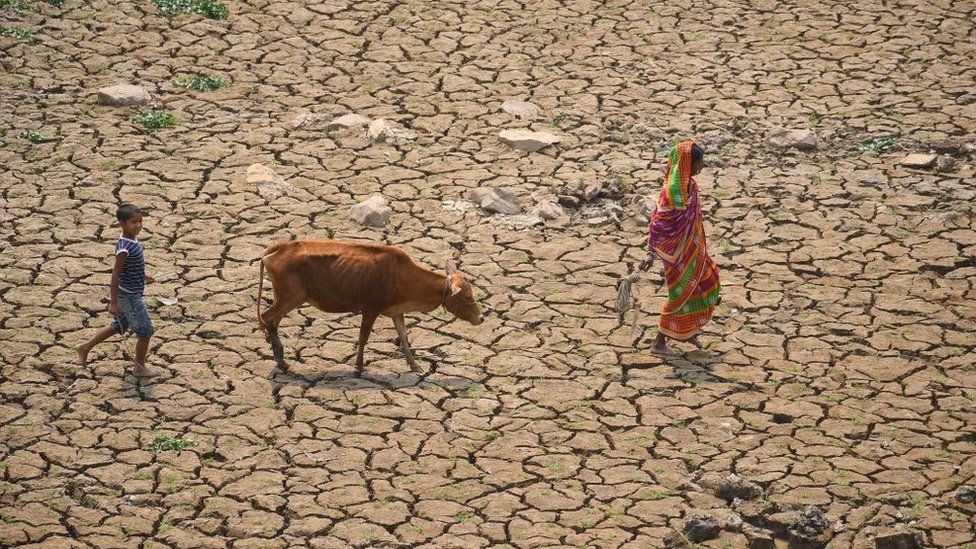 Image source, Getty Images
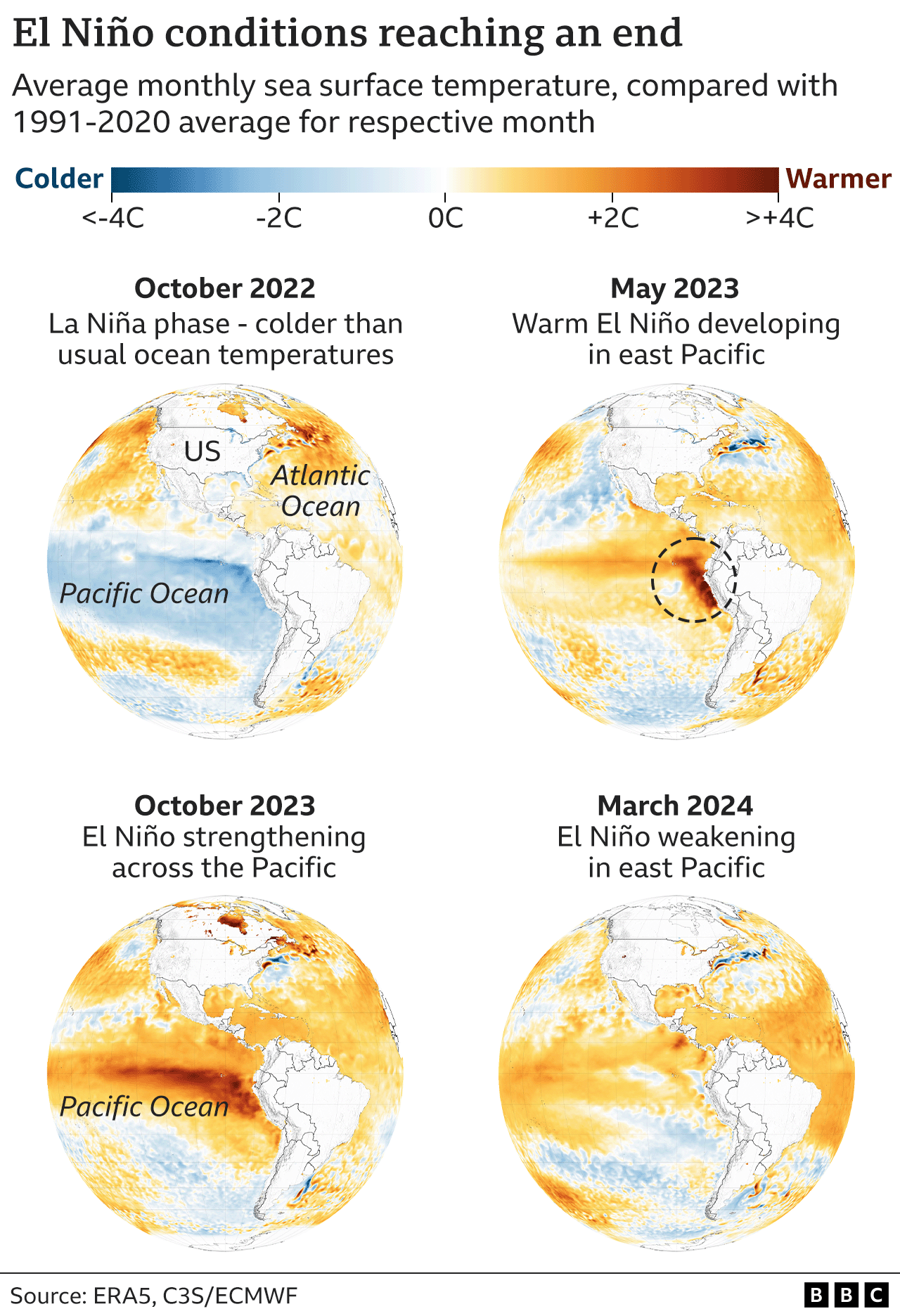
The powerful El Niño weather event which along with climate change has helped push global temperatures to new highs, has ended, say scientists.
The Australian Bureau of Meteorology says the Pacific Ocean has “cooled substantially” in the past week.
This naturally occurring episode that began last June brought warmer waters to the surface of the Pacific, adding extra heat to the atmosphere.
But what happens next is uncertain, say researchers.
A string of recent global monthly high temperature records has led some scientists to fear that the world could be tipping into a new phase of even faster climate change.
Scientists say that the months after the end of El Niño will give a strong indication as to whether the recent high levels of warming are due to accelerated warming or not.
Every few years, the onset of El Niño brings dramatic change to weather in many parts of the world.
The surge of warmer water that comes to the surface off the coast of Peru in South America is linked to increased droughts and floods in different parts of the world.
The full name of the pattern is the El Niño-Southern Oscillation or ENSO.
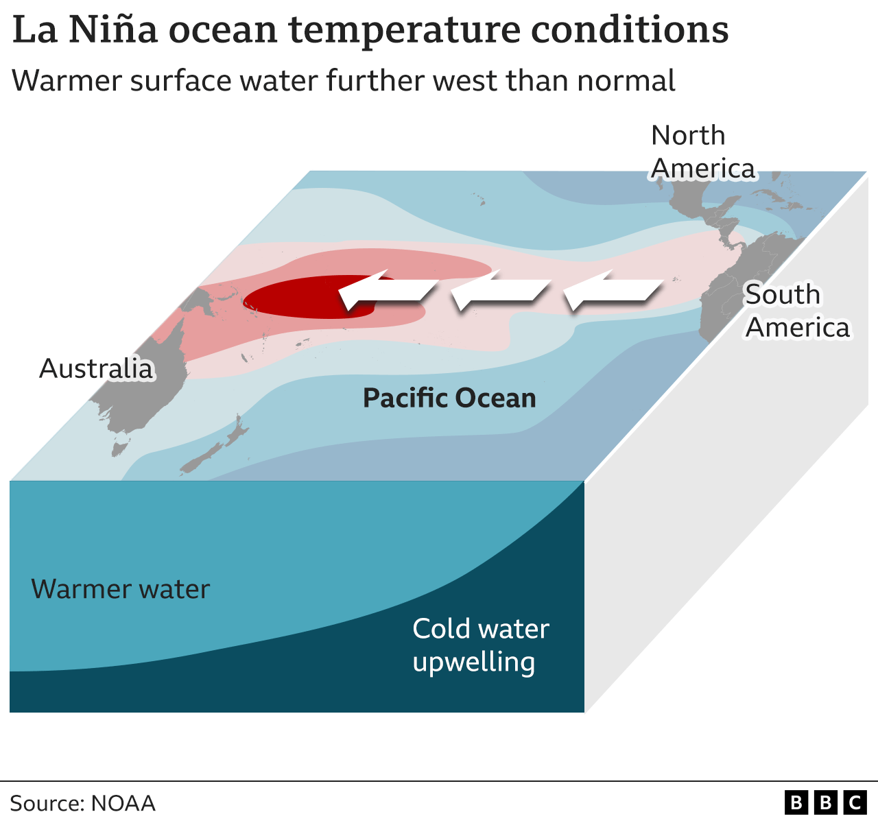
It’s marked by three different phases, the hot El Niño, neutral conditions or a cooler period called La Niña.
This current El Niño was declared last June, and reached a peak in December.
The resulting warmer water in the Pacific has helped push global average temperatures to new highs, with March making it ten months in a row to break the record for that period.
But now, perhaps quicker than expected, El Niño is gone.
The critical question is what happens next and on this scientists are divided.
US researchers recently said there was 60% chance of a La Niña developing between June-August, and an 85% chance of this happening by Autumn.
But the Australian Bureau say such statements such be treated with caution. They expect neutral conditions to last until at least July.
They point to the current hot state of the global oceans which they believe is affecting ENSO.
“As the current global ocean conditions have not been observed before, inferences as to how ENSO may develop in 2024 that are based on past events may not be reliable,” they said in a statement.
Whether or not a La Niña forms really matters, say researchers.
It can have a significant impact on storms and hurricanes, with some experts predicting that if La Niña does arrive, it would herald a highly active hurricane season in the Atlantic.
La Niña’s cooling effect may also slightly slow the rate of global heating.
That might indicate that the record temperatures experienced over the past year were something of a mystery, and not evidence that the world has moved into a more rapid phase of warming.